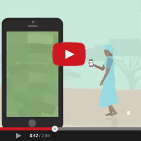
Later this month, several hundred villagers of Ilalasimba, Tanzania will receive formal documentation of their land rights thanks to a USAID pilot project called Mobile Application to Secure Tenure (MAST). Launched in 2014, the pilot tests an innovative approach to mapping and registering land rights. Through an easy to use, open-source mobile application, the project empowers villagers with the training and tools to identify parcel boundaries and gather the demographic and tenure information that government officials need to issue formal land rights documents called Certificates of Customary Rights of Occupancy. This makes the process of securing land rights more timely, accessible and transparent for local people and communities.
“BEFORE THIS, MANY PEOPLE DID NOT UNDERSTAND THE IMPORTANCE OF LAND AND THEIR RIGHTS ON LAND.”
USAID has developed a participatory methodology to implement the pilot, combining the use of technology with village-wide trainings on Tanzania’s land laws to build knowledge and strengthen capacity to support dispute resolution.
The approach works this way: first, village and hamlet-level workshops provide training on the legal framework of Tanzania’s land laws to members of the Village Assembly, Village Council, Land Adjudication Committee and others, with a special emphasis on women’s rights to own and inherit land. Next, USAID works with villagers to select and train a small group of young villagers to use the mobile application on Android-based smartphones.
These young people, called Trusted Intermediaries, then work alongside members of the village Land Adjudication Committee to map the boundaries of villagers’ land and enter demographic and other information about parcel holders. The intermediaries make certain that parcel holders (or their representatives) and the neighbors of parcel holders are present when mapping occurs.
Oftentimes, conflicts arise when rights to land and property are being demarcated and recorded. In order comply with Tanzania’s law and to reduce this risk, the four women and four men on the Land Adjudication Committee play a critical role resolving disputes that arise between family members or owners of neighboring parcels and validating the claims of parcels holders.
The information collected by intermediaries is then uploaded to a cloud-based database where government officials can access and validate it. Once validated by the District Land Office, the government is able to issue formal recognition of land rights, certificates, to villagers. This community-driven process is helping build local capacity and addresses one of the major bottlenecks in the traditional process of formalizing land rights: a dearth of surveyors.
The results from first phase of the pilot project are encouraging: In just under three weeks, the intermediaries mapped and collected information for 937 parcels. Some even went a step further and learned how to validate the data that they collected in the field. Jackline Nyantalima, a 23-year old woman said of her experience as a Trusted Intermediary: “This work provided priority to women. I was trained on land rights. Before this, many people did not understand the importance of land and their rights on land. This work has importance for our society.” Her colleague, Desmond Chumbula, a 30-year old man said: “I can tell the importance of this [work]. Before we were using paces to measure land, now we have a simplified process and you really know the size of your farm.”
With greater clarity about ownership and parcel size villagers should have enhanced security and increased incentives to invest in their property. This change may be particularly important for women: as Village Council member Ms. Sandina Kasike said in May:
“Before this project, widows were dispossessed. Now I see I have rights too. This means the future generation will be better off. Even if I pass away, my grandchildren and great grandchildren will have rights to own this land.”
Now the women of Ilalasimba have greater security and protection for their assets; USAID registered 30% of parcels in the names of women alone; 40% were registered jointly to men and women and another 30% were registered to men alone.
In July, when the certificates are delivered to the women and men of Ilalasimba, the project will meet a major milestone: providing local people with formal recognition of their rights. However, the project will not end there. USAID is expanding to two other villages in Tanzania and, as a result, will help improve land tenure security and enhance capacity for several hundred more people – the beginning of a big change in Tanzania’s villages.